The geological story of southern Spain |
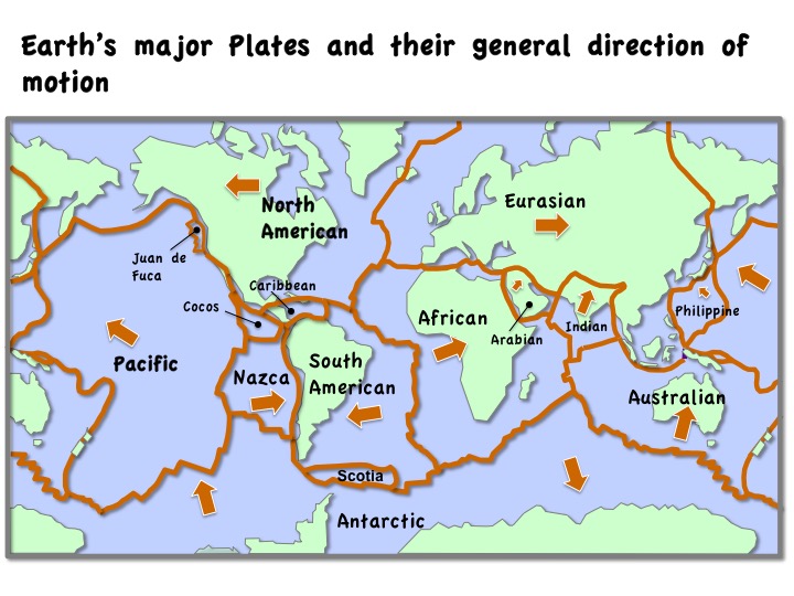
Source: US Geological Survey
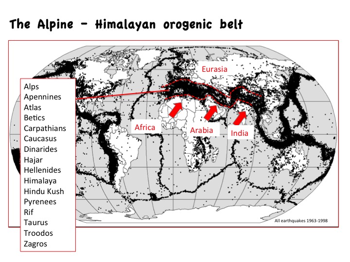
Source: Image from wikipedia.com (Earthquakes). Public domain NASA data.
|
The geological story of southern Spain |
Source: US Geological Survey
Source: Image from wikipedia.com (Earthquakes). Public domain NASA data.
|
