Individual places and topics of interest
Alboran Basin
|
|
|
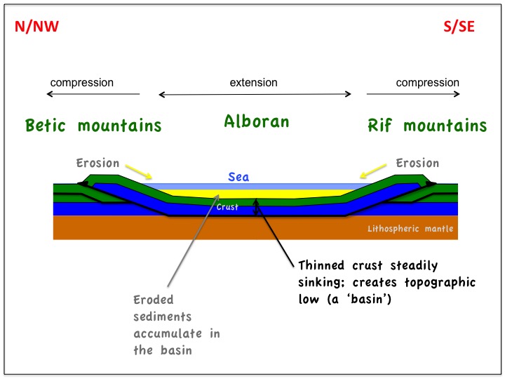
During the collisional phase, the Crust that underlies the present day Alboran Sea was being stretched and thinned as a result of the subduction front being dragged westwards and thrusting happening either side to the north and south (Chapter 3). At the same time, large amounts of sediment were being washed in from erosion of the rising mountains to the north and south. These are classic conditions for the development of a sedimentary basin - gradually sinking Crust with large amounts of sediment filling in the deepening topographic low. The resulting sedimentary basin is visible on seismic data - a technique commonly used by the oil industry to image layers of rock down to 10km or more. Think of it as a giant echo sounder able to penetrate into the rocks themselves rather than just the surface. A seismic section across part of the Alboran Basin is shown opposite overlain with its interpretation. (It shows the seabed and the rock beneath it to a total depth of about 10km. The browny coloured, stripy section is the raw seismic data showing layers of sediment and sedimentary rock. The black faults, blue basement and orange volcanics are interpretations overlaid on the seismic data).
As the sediments successively layer on top of each other they gradually lithify into harder and harder rock (Background - Rocks). There is now up to 8km of sedimentary infill in the basin dating from about 20 million years ago (beginning of the Miocene) - and sediment is still pouring in from the enclosing rivers and beaches today. The floor of basin - the "basement" - is made of the same Chapter 1 and 2 rocks that form the surrounding Internal Betics and Internal Rif mountains. Also visible on this seismic line is an example of one of the Alboran's 'volcanoes' , causing an underwater topographic ridge. (see also the profile on Cabo de Gata). |
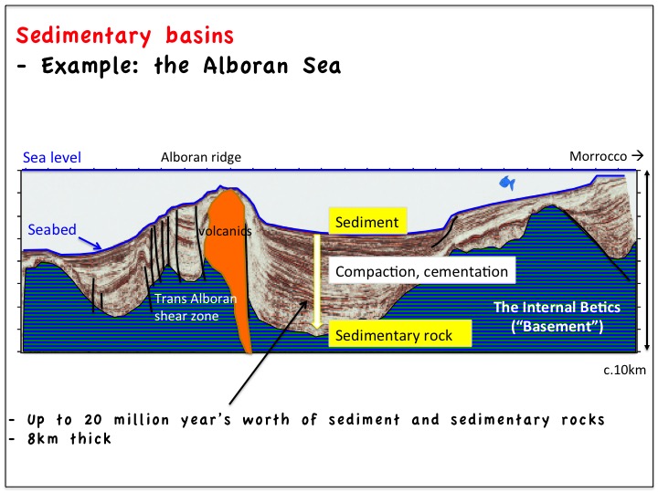
Source: Seismic line and interpretation from Martinez-Garcia et al
|
